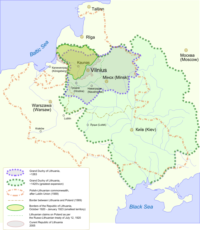
Map Info & Chart : A map of Lithuania’s historical territorial expansion and contraction [1,519 × 1,743].
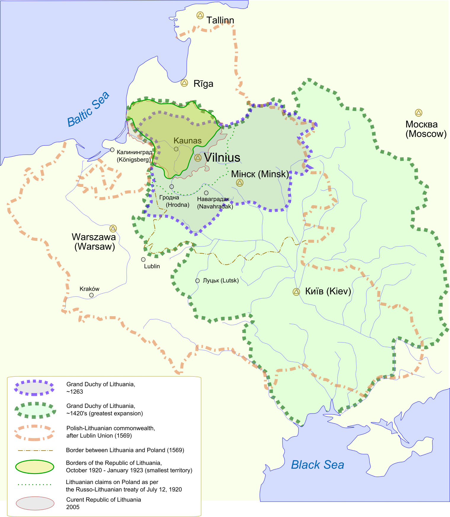
A map of Lithuania’s historical territorial expansion and contraction [1,519 × 1,743].
By Futurist110
At infographic.tv we provide handpicked collection of the best infographics and data charts from around the world.