in

Map : Map of the Lanfang Republic (1777–1884), a Chinese state in the island of Borneo, Indonesia

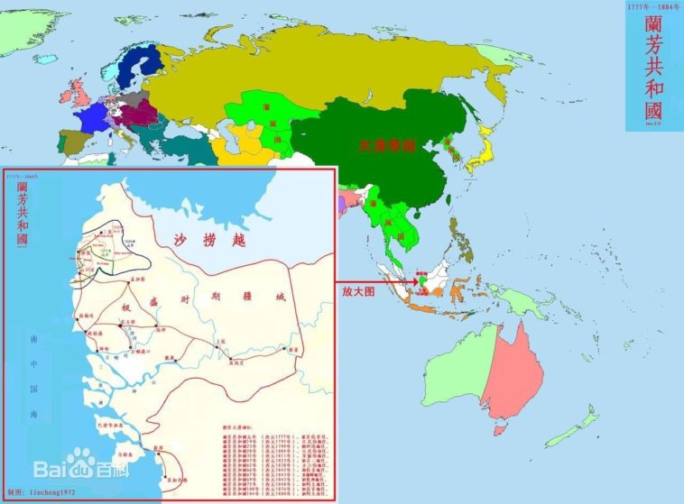
Map Info & Chart : Map of the Lanfang Republic (1777–1884), a Chinese state in the island of Borneo, Indonesia

Map of the Lanfang Republic (1777–1884), a Chinese state in the island of Borneo, Indonesia

By bush-

At infographic.tv we provide handpicked collection of the best infographics and data charts from around the world.

  • Sharing is caring !
  • What do you think?

    460 Points
    Upvote Downvote

    Leave a Reply

    Your email address will not be published. Required fields are marked *

    Video Infographic : Judaism Infographic

    Visual : Mountains of the world measured from sea level