Map Info & Chart : [Question] Why are older Amsterdam maps made to face south?
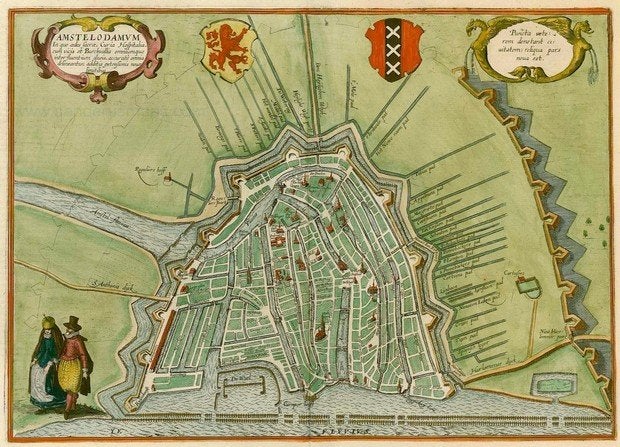
I’ve been looking for an older map of Amsterdam for my house, and as I look, the older the map, the more likely it has Amsterdam on a south-to-north axis, rather than it’s actual north-to-south axis. Here’s an [example](https://www.sanderusmaps.com/en/our-catalogue/detail/163626&e=antique-map-of-amsterdam-by-braun–hogenberg/). I have to admit, I’m not entirely sure I’ve ever seen a city map done like this, and I was wondering if anyone had an explanation.
By Helens_Moaning_Hand
At infographic.tv we provide handpicked collection of the best infographics and data charts from around the world.