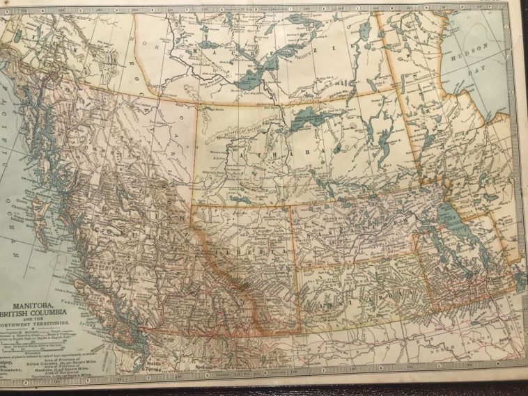
Map Info & Chart : 1906 map of Western Canada. Only 2 provinces, British Columbia and a small Manitoba
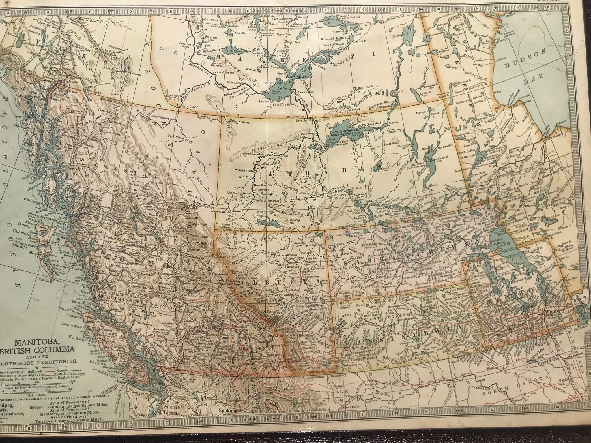
1906 map of Western Canada. Only 2 provinces, British Columbia and a small Manitoba
By Thick_Slice
At infographic.tv we provide handpicked collection of the best infographics and data charts from around the world.