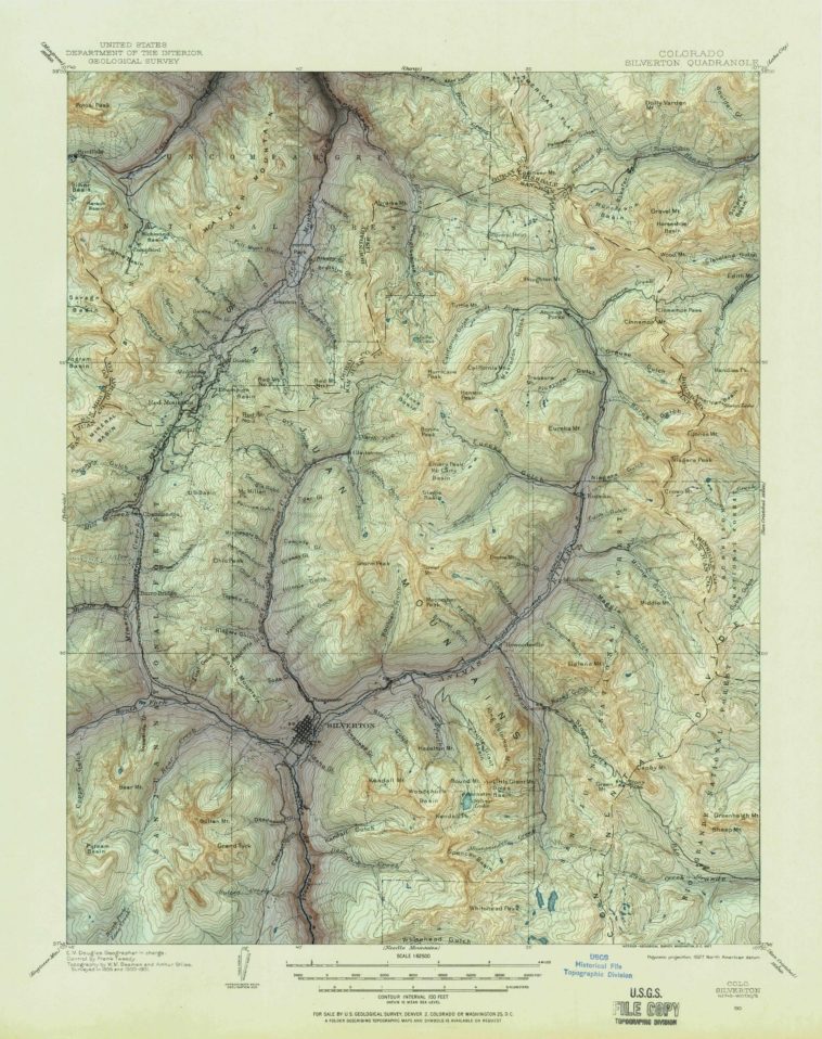
Map Info & Chart : 1927 USGS topographic map of the area surrounding Silverton, CO with hillshading and color mapping from modern elevation data.
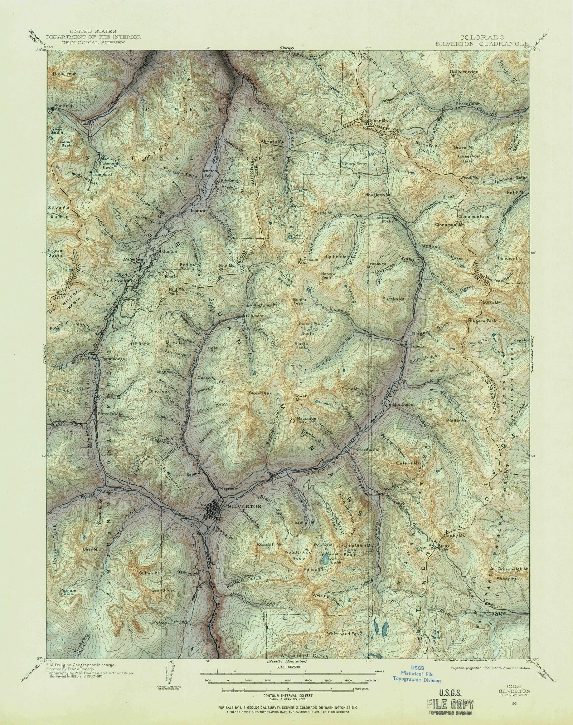
1927 USGS topographic map of the area surrounding Silverton, CO with hillshading and color mapping from modern elevation data.
By the_television
At infographic.tv we provide handpicked collection of the best infographics and data charts from around the world.