Map Info & Chart : 3D Population Density of counties around and near the Great Lakes
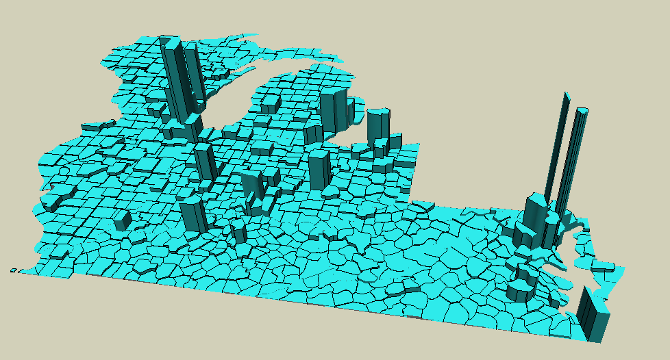
3D Population Density of counties around and near the Great Lakes
By AJgloe
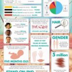
At infographic.tv we provide handpicked collection of the best infographics and data charts from around the world.