in

Map : Elevation Profiles of the USA at Various Latitudes (made using CalTopo)

Map Info & Chart : Elevation Profiles of the USA at Various Latitudes (made using CalTopo)
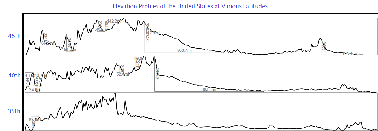
Elevation Profiles of the USA at Various Latitudes (made using CalTopo)

By losttofound

At infographic.tv we provide handpicked collection of the best infographics and data charts from around the world.

  • Sharing is caring !
  • What do you think?

    459 points
    Upvote Downvote

    Leave a Reply

    Your email address will not be published. Required fields are marked *

    Loading…

    Map : What’s the best way to frame a vintage map?

    Map : I made this map of Gettysburg National Military Park. It’s designed to be an 11”x14” printed map so some of the labels might be hard to read on here. What’s everyone think? I got most vector data from OSM and the elevation from USGS then extracted the contours. Everything was done in QGIS