Map Info & Chart : Help reading a coal mine map

Hi
I am playing with hobby video game project. Nothing fancy, commercial, political, ambitious etc. and was looking at some coal mine maps of some abandoned coal mines in US/Eastern Ohio/Perry County
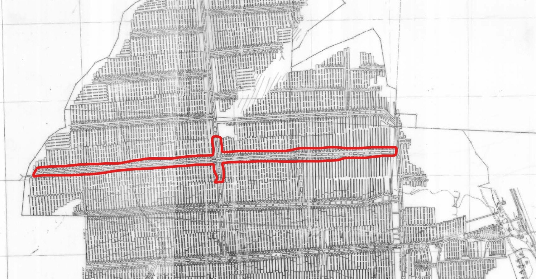
(Cut out / image) https://imgur.com/a/OYGpSkc
I am not familiar with coal mines, but am I right if I read the large dotted lines on the map as tunnels (see red/marked example on the image)?
And the many thin lines as just scribbles pointing to rock/limestone etc.?
Source / Complete map (1.3Mb PDF) : https://apps.ohiodnr.gov/Website/Geosurvey/Underground_Mines/341158000102.pdf
Thank you in advance and let me know if this question belongs to another sub
By thousande
At infographic.tv we provide handpicked collection of the best infographics and data charts from around the world.


