in

Map : Irish, Britons and Anglo-Saxons AD 600

Map Info & Chart : Irish, Britons and Anglo-Saxons AD 600
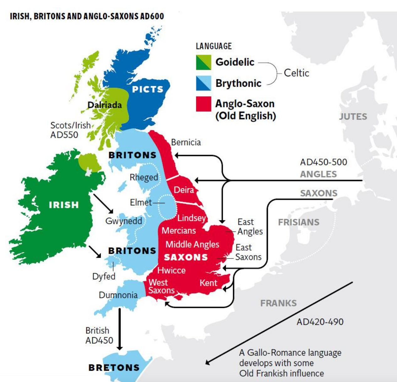
Irish, Britons and Anglo-Saxons AD 600

By PtrTlr

At infographic.tv we provide handpicked collection of the best infographics and data charts from around the world.

  • Sharing is caring !
  • What do you think?

    459 points
    Upvote Downvote

    Leave a Reply

    Your email address will not be published. Required fields are marked *

    Loading…

    Map : I new some help!! I am creating my own detailed world. the idea is that this is a earth like planet, that we have colonized. I will eventually turn this into a large detailed map. each country is separated by color. I need help with Country/ city names!!

    Visual : A helpful chart of words to combine for unique insults (X-Post from r/rareinsults)