Map Info & Chart : Map of land usage in Haiti created using high resolution satellite imagery, showing tree cover at 32.3%
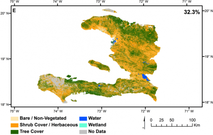
Map of land usage in Haiti created using high resolution satellite imagery, showing tree cover at 32.3%
By archelon2001
At infographic.tv we provide handpicked collection of the best infographics and data charts from around the world.