in

Map : Map of location of Austro-Hungarian warships in Austrian main war port Pola (now Pula, Croatia) according to the data of Italian air reconnaissance as of October 22, 1918
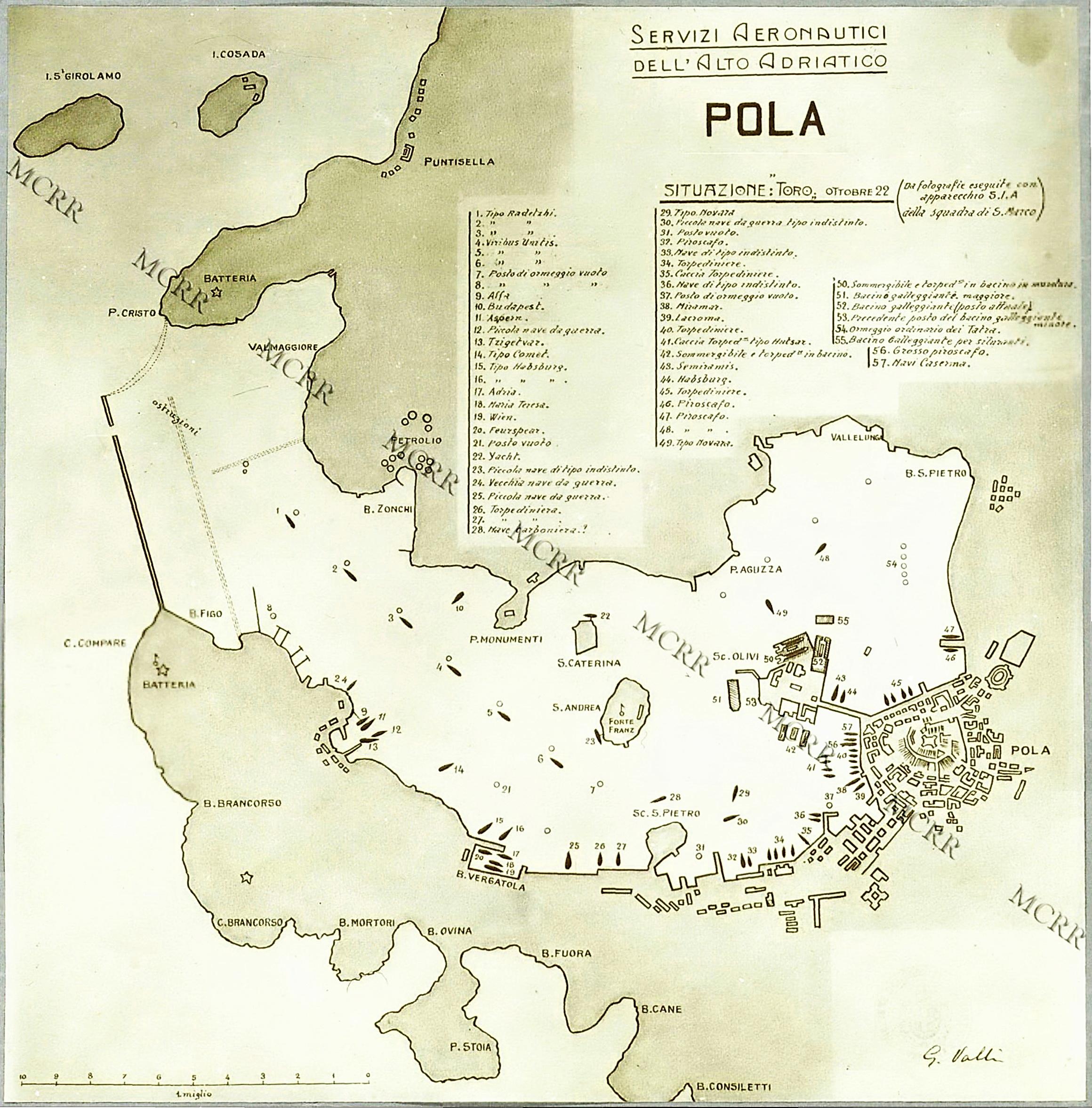
Map Info & Chart : Map of location of Austro-Hungarian warships in Austrian main war port Pola (now Pula, Croatia) according to the data of Italian air reconnaissance as of October 22, 1918

Map of location of Austro-Hungarian warships in Austrian main war port Pola (now Pula, Croatia) according to the data of Italian air reconnaissance as of October 22, 1918

By maduroarsenal

At infographic.tv we provide handpicked collection of the best infographics and data charts from around the world.

  • Sharing is caring !
  • What do you think?

    459 points
    Upvote Downvote

    Leave a Reply

    Your email address will not be published. Required fields are marked *

    Loading…

    Map : Arkansas rotated 90 degrees looks similar to Nevada, kinda neat

    Map : Countries that have dominant yellow, green and red in their national flag