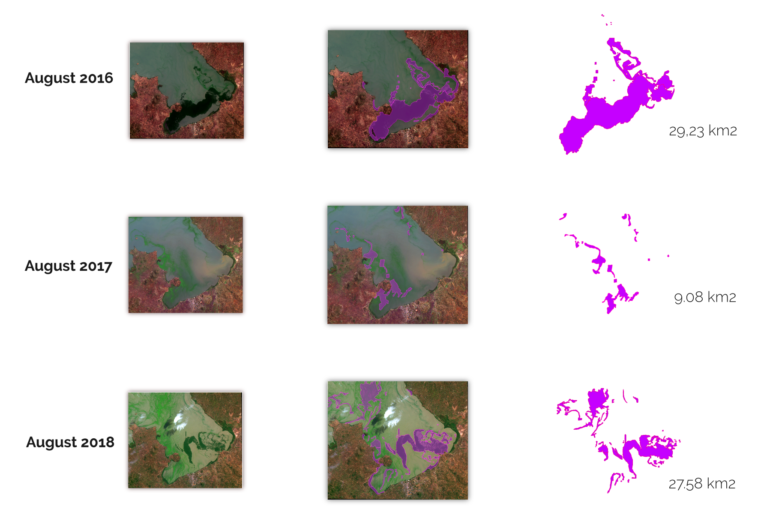
Map Info & Chart : Satellite Imagery Processing with Deep Learning to detect Invasive Water Species in Lake Victoria. Link here: https://cartometrics.com/blog/invasive-water-species
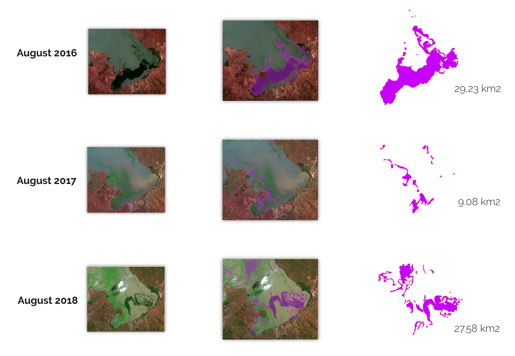
Satellite Imagery Processing with Deep Learning to detect Invasive Water Species in Lake Victoria. Link here: https://cartometrics.com/blog/invasive-water-species
By cartometrics
At infographic.tv we provide handpicked collection of the best infographics and data charts from around the world.