Map Info & Chart : Software for Maps with Annotations
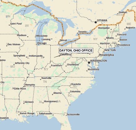
At work we use Delorme Street Atlas to create map images with the locations of a client’s offices on them for our reports. Delorme’s pretty old now and we’re looking for a replacement. What we need is something that looks like a map (not a satellite view) that we can mark up and put annotations at multiple location on it. I’ve looked at Google Maps, but it wasn’t really what we’re looking for. Any suggestions? [**Here**](https://imgur.com/yn3vFA3) is the sort of thing we’re doing now with Street Atlas. Thanks!
By RecursiveBob
At infographic.tv we provide handpicked collection of the best infographics and data charts from around the world.