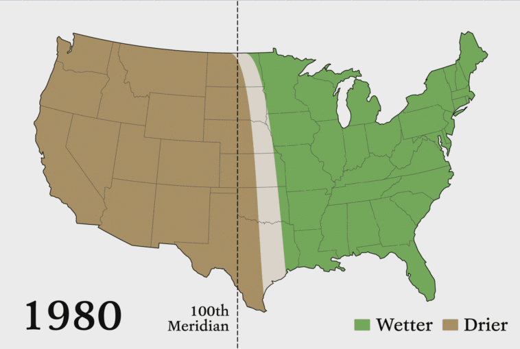
Map Info & Chart : The U.S. climate boundary that separates the humid east from the more arid west, has shifted 140 miles east since 1980
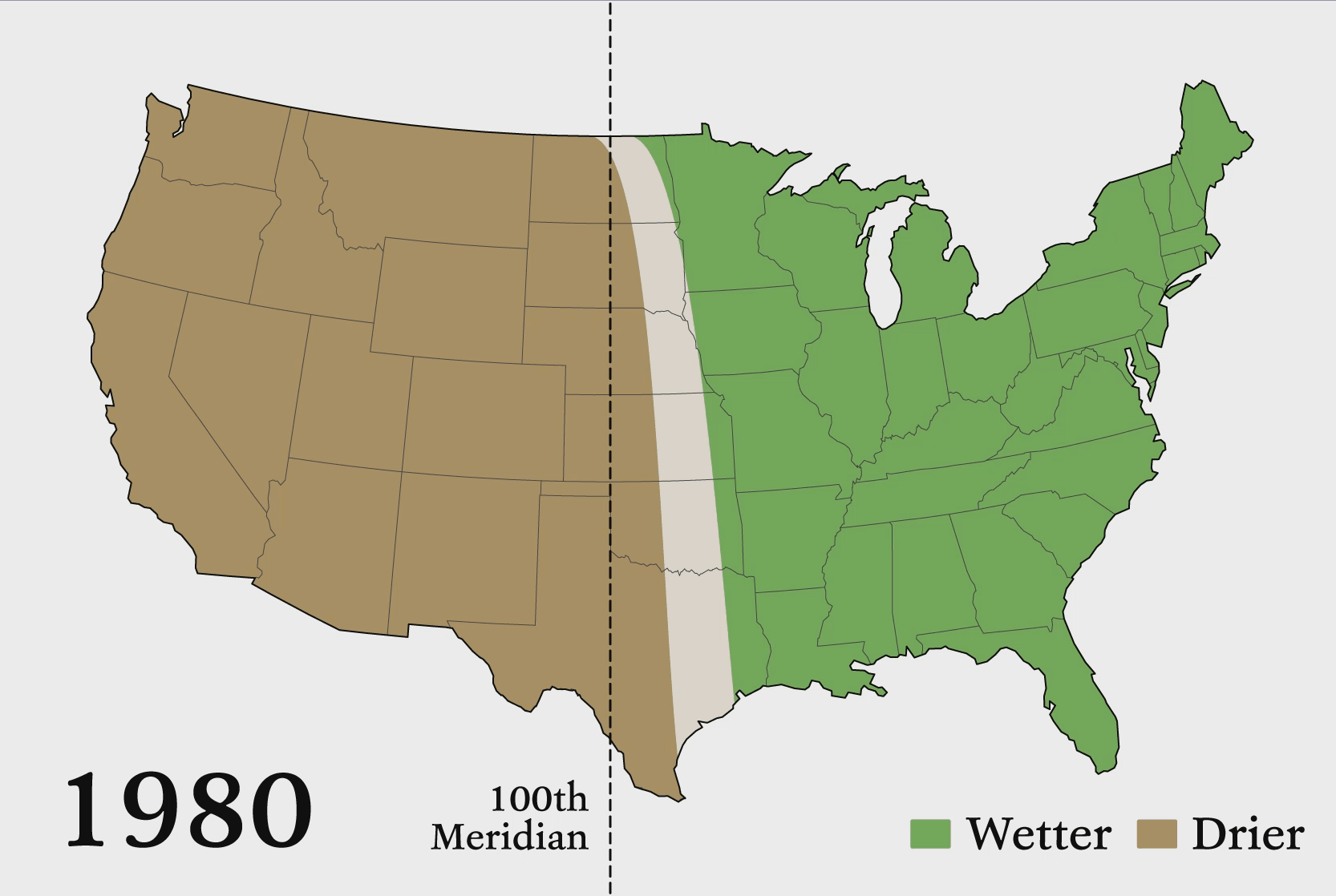
The U.S. climate boundary that separates the humid east from the more arid west, has shifted 140 miles east since 1980
By AJgloe
At infographic.tv we provide handpicked collection of the best infographics and data charts from around the world.