in

Map : A county map of the 1888 US presidential election (Cleveland vs. Harrison, round 1) [2,800 x 1,700].

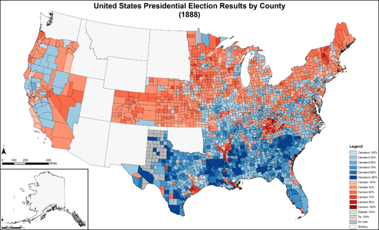
Map Info & Chart : A county map of the 1888 US presidential election (Cleveland vs. Harrison, round 1) [2,800 x 1,700].

A county map of the 1888 US presidential election (Cleveland vs. Harrison, round 1) [2,800 x 1,700].

By Futurist110

At infographic.tv we provide handpicked collection of the best infographics and data charts from around the world.

  • Sharing is caring !
  • What do you think?

    459 points
    Upvote Downvote

    Leave a Reply

    Your email address will not be published. Required fields are marked *

    Loading…

    Video Infographic : Mẫu trình chiếu Infographic Powerpoint | Infographic PowerPoint Presentation Template

    Data Chart : 7 Vehicles To Survive The End Of The World [Infographic