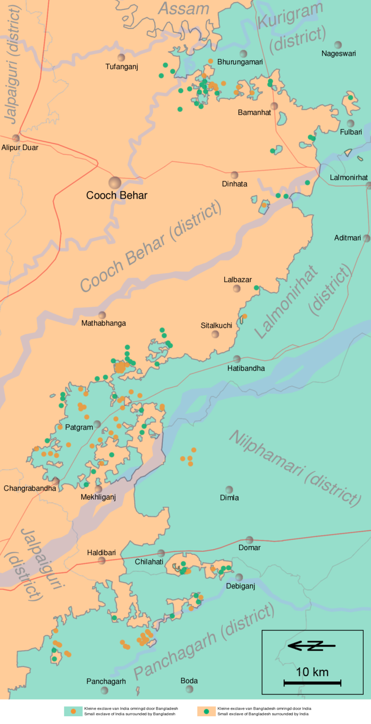
Map Info & Chart : A map of the Indo-Bangladeshi border enclaves before 2015 [1,100 x 2,148].
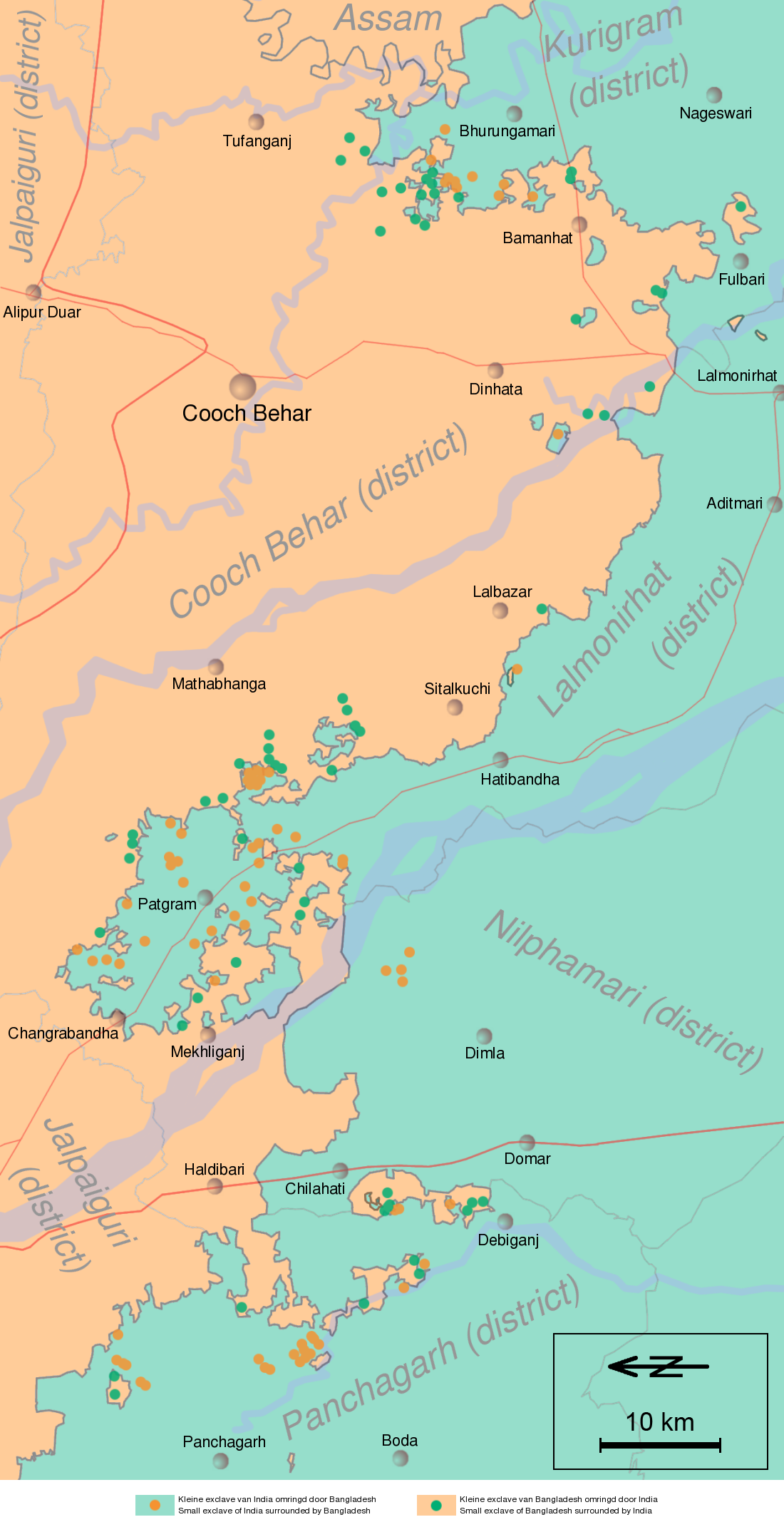
A map of the Indo-Bangladeshi border enclaves before 2015 [1,100 x 2,148].
By Futurist110
At infographic.tv we provide handpicked collection of the best infographics and data charts from around the world.