Map Info & Chart : An 1897 cartogram (map) of US cities and towns by population [900 x 569].
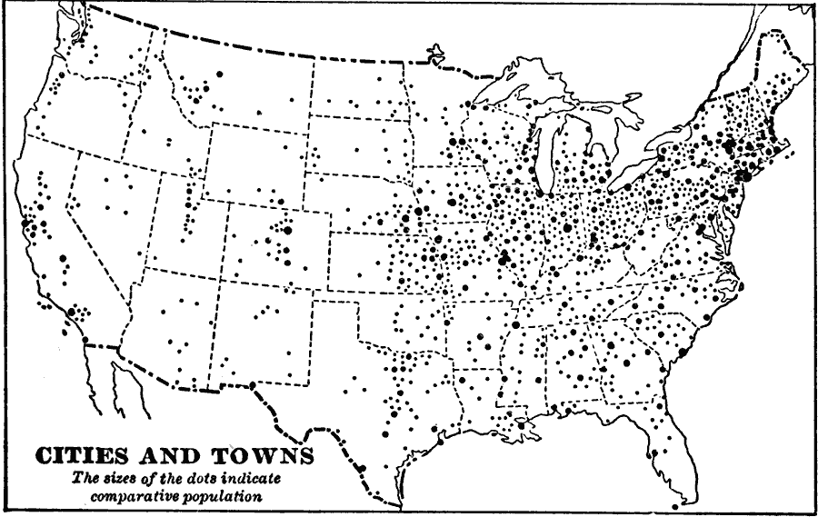
An 1897 cartogram (map) of US cities and towns by population [900 x 569].
By Futurist110
At infographic.tv we provide handpicked collection of the best infographics and data charts from around the world.