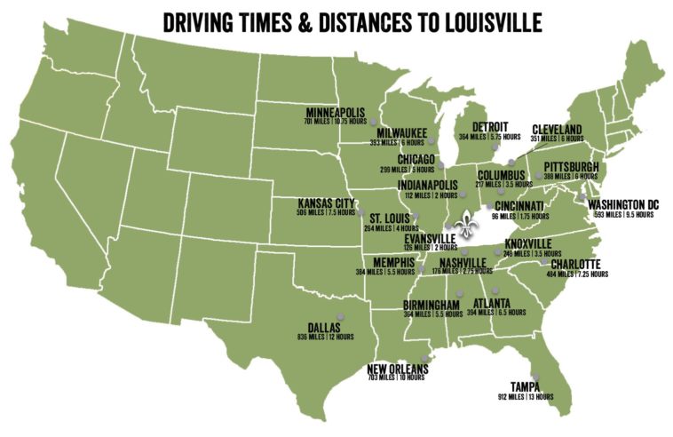
Map Info & Chart : Guys, does anybody know of a US map with travel/driving times between states/cities?
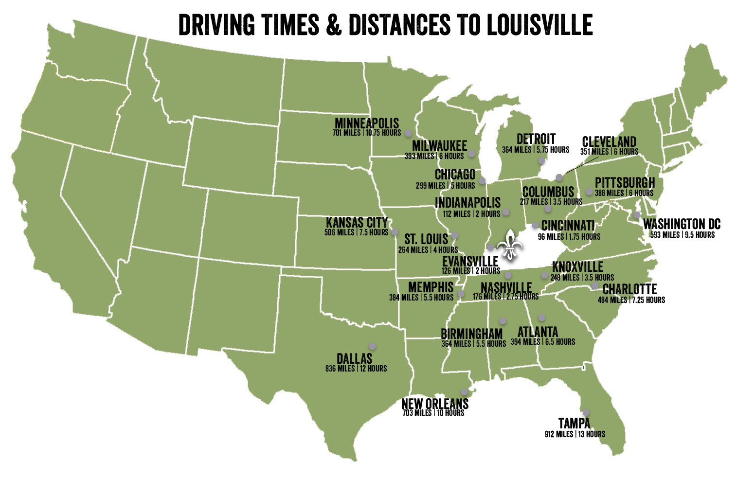
Been searching around and only found one map with driving times to Louisville:
https://www.gotolouisville.com/images/uploads/CMS/USA-States-Driving.jpg
Would be nice to have a whole map of mainland USA with driving times between states and capital cities if possible, for example, Seattle to Columbus or Austin to Atlanta.
Thanks Reddit!
By whatupwithit
At infographic.tv we provide handpicked collection of the best infographics and data charts from around the world.