Map Info & Chart : How to see all ZIP Code boundaries on Google Maps
First County Lines, now [ZIP Codes on Google Maps](https://www.randymajors.com/p/zipcodegmap.html)!
After the [great response](https://blog.eogn.com/2018/09/28/update-on-displaying-county-lines-on-google-maps/#comment-386858) to my [County Lines on Google Maps](https://www.randymajors.com/p/countygmap.html) tool, I’ve heard a number of suggestions for other types of boundaries that Google Maps doesn’t show. One that has come up a number of times is for ZIP Codes.
Yes, you can see one ZIP Code boundary at a time on Google Maps desktop version, but that’s of limited use if you’re trying to see all of the ZIP Codes in an area and don’t know what they are (for example, it’s not intuitive how to get Google Maps to show the ZIP Code boundary for the place adjacent to the current ZIP Code you’re viewing).
So I’ve created another free tool that shows ZIP Code boundaries on Google Maps here: [ZIP Codes on Google Maps](https://www.randymajors.com/p/zipcodegmap.html)
​
Blog post for more details can be found [here](https://www.randymajors.com/2018/10/first-county-lines-now-zip-codes-on.html).
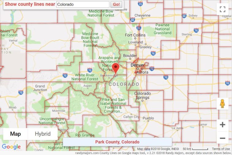
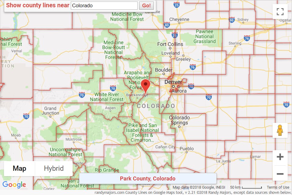
Sample screenshot here:
https://i.redd.it/51r1f4dfmkv11.png
By rlmcony
At infographic.tv we provide handpicked collection of the best infographics and data charts from around the world.