Map Info & Chart : Nebraska flooding from satellite images (courtesy Copernicus EU)
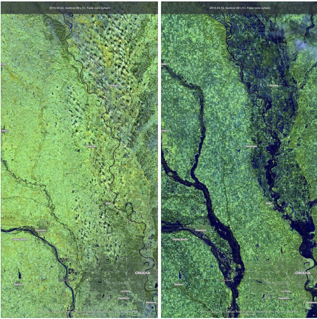
Nebraska flooding from satellite images (courtesy Copernicus EU)
By daisylion_
At infographic.tv we provide handpicked collection of the best infographics and data charts from around the world.