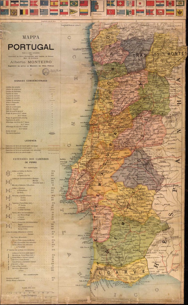
Map Info & Chart : Railway network in Portugal (early 20th c.) [2382×3892]
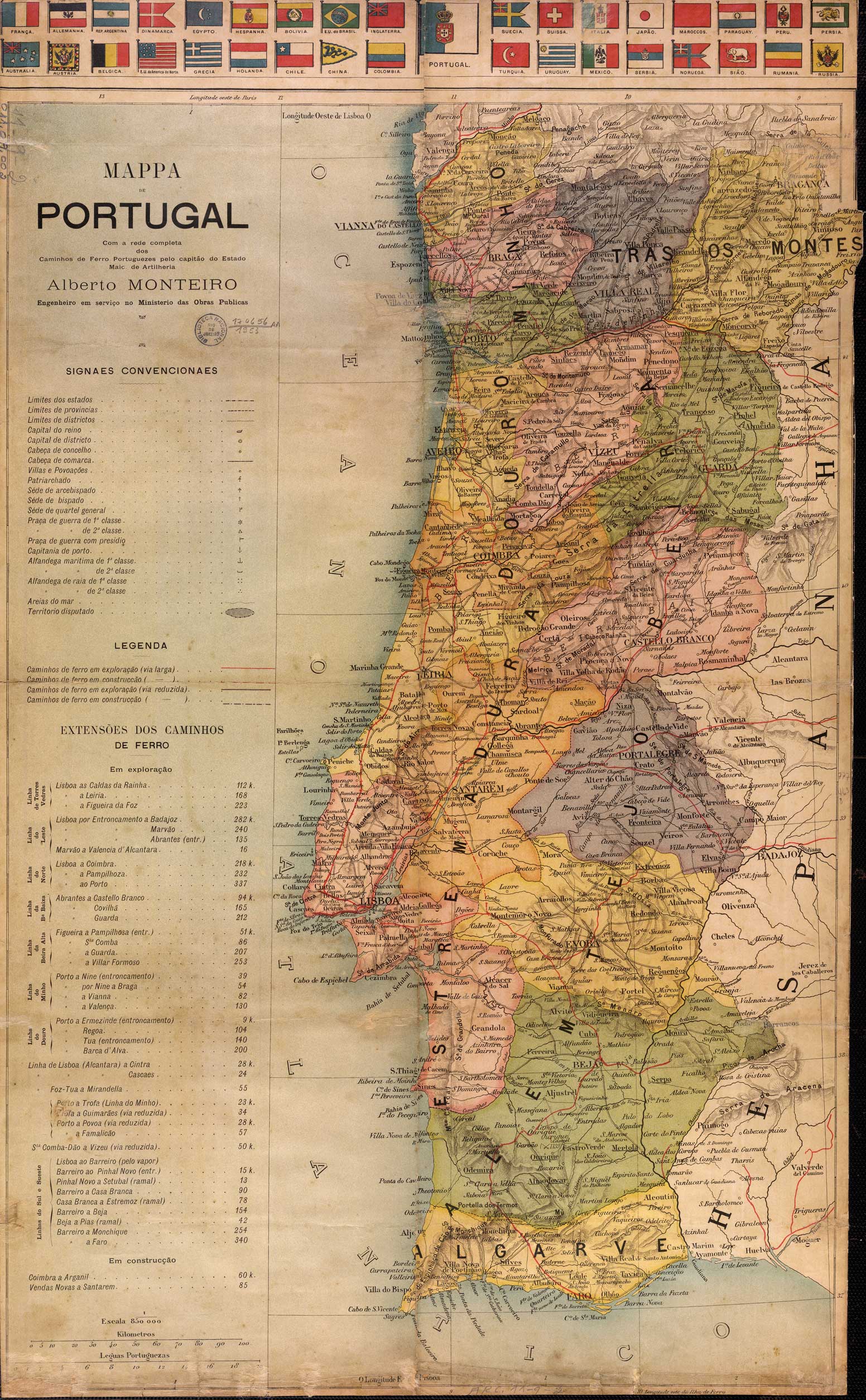
Railway network in Portugal (early 20th c.) [2382×3892]
By Homesanto
At infographic.tv we provide handpicked collection of the best infographics and data charts from around the world.