Map Info & Chart : Syria, Iraq, and Islamic State from the start of 2017 to Christmas 2018 [5104 x 6878]
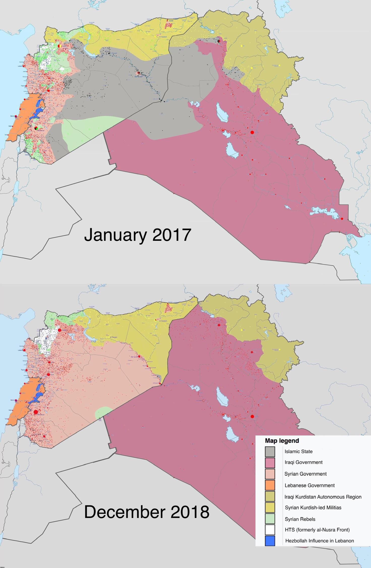
Syria, Iraq, and Islamic State from the start of 2017 to Christmas 2018 [5104 x 6878]
By Ollieca616
At infographic.tv we provide handpicked collection of the best infographics and data charts from around the world.