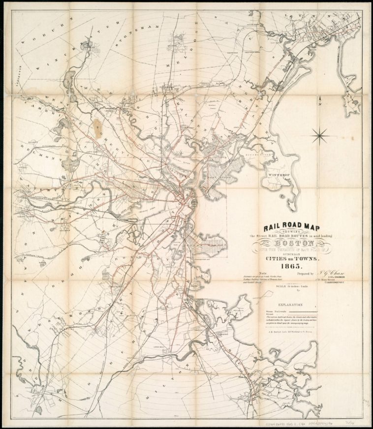
Map Info & Chart : Rail Road Map showing the street rail road routes in and leading from Boston, with the terminus of each road in suburban cities or towns, 1865. [4348×5000]
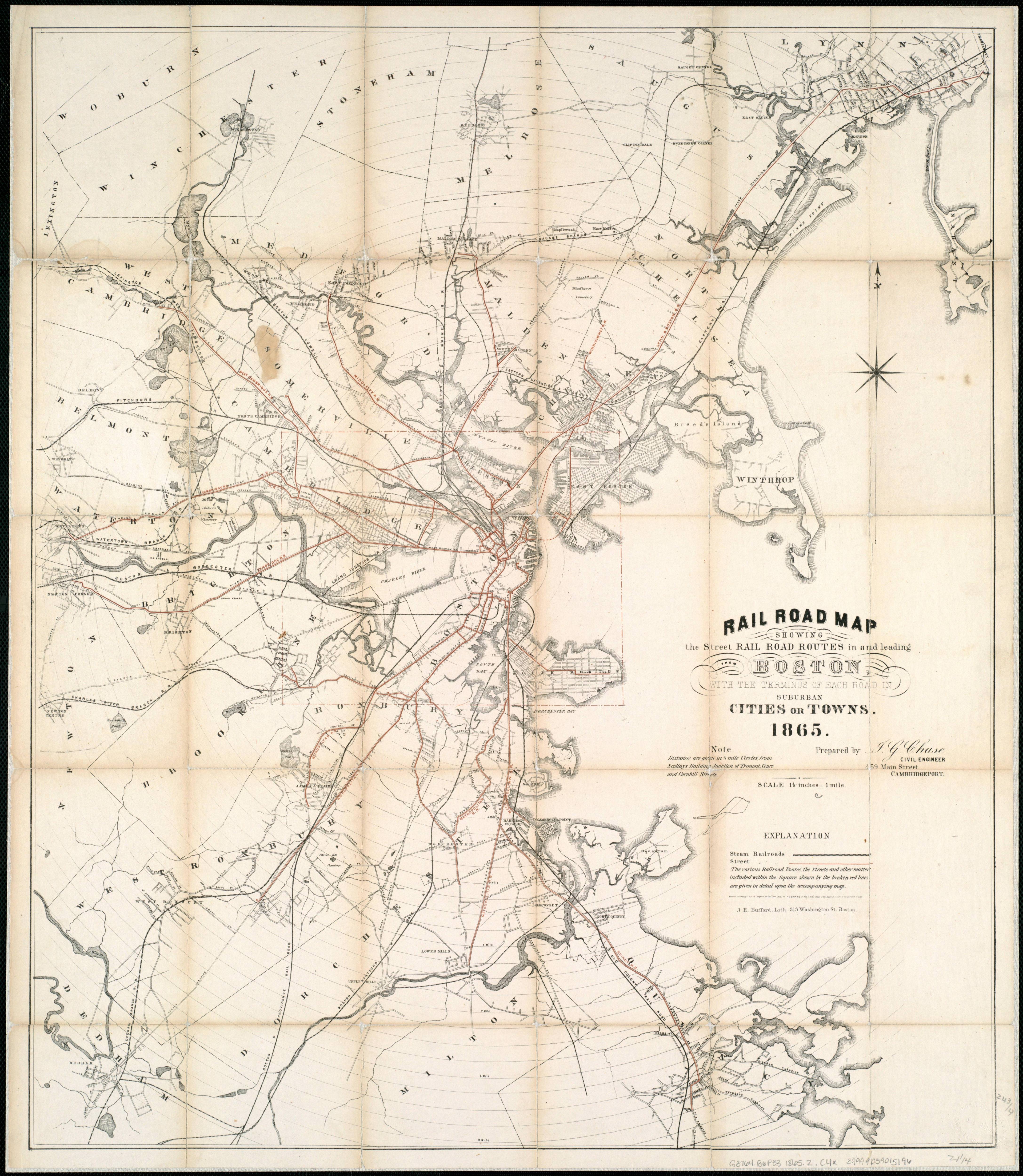
Rail Road Map showing the street rail road routes in and leading from Boston, with the terminus of each road in suburban cities or towns, 1865. [4348×5000]
By sverdrupian
At infographic.tv we provide handpicked collection of the best infographics and data charts from around the world.